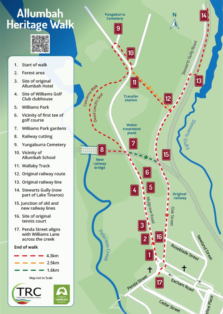
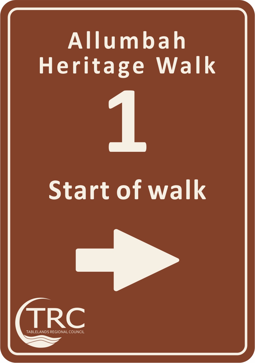
The Allumbah Heritage Walk starts at the Our Lady of Consolation and St Patrick Church on Mulgrave Road in Yungaburra.
Welcome to Country
Nyundu gurriny bama!
Nganyji bama Dulgubarra Yidinji bujin yunduubany gadaana Janggaburru yinggugu. Yalungunda nganyji guman wabu gadan jiba durrgan, nganyji wabar wabu yingu gabay.
Hello Everyone!
We the Dulgubarra Yidinji people welcome you all to come here to Yungaburra. Today we all come together as one with a happy heart and we all walk together on this pathway. Welcome.
History Of The Area
Allumbah was the original name of the village in this area as laid out in the 1887 survey plan, just to the north of Yungaburra.
In 1910, coinciding with the opening of the new railway line, it was decided to move the village to its current location and rename it Yungaburra (see point 9). This name is taken from the local Yidinji word Janggaburru, which means Silver Ash.
Lush rainforest and clear streams provided abundant food for the Dulgubarra Yidinji Aboriginal people. They were skilled hunters who applied a range of methods depending on need, location and available resources, and knowledge of country, weather patterns, seasonal changes and celestial observations enhanced their hunting ability. The Dulgubarra Yidinji people maintain their ongoing connection with country, local history and language.
Explore the walk using this page or download the Allumbah Heritage Walk brochure or the combined Yungaburra Walking Trails brochure.
Allow 2hr walking time for the 4.3km track, although there are shorter walking options at points 7 and 12. Wear appropriate footwear, hat and clothing and carry drinking water. Take care near roads and along the track. Happy walking!
The Yungaburra Bicentennial Walking Track was created as part of an Australian Bicentennial Project in 1988. Landcare volunteers revisited the project in 2021 to renew interest in the local Aboriginal culture, early European settlement, and native flora and fauna.
This walk complements other established Yungaburra trails — the Old Town Loop: A Walking Trail Through Yungaburra’s Past and the Peterson Creek track. Brochures for these trails are available from the Yungaburra Visitor Centre.
Our Lady of Consolation and Saint Patrick Church was officially opened on 26 April 1913. It was designed by Cairns architect EG Waters and built by GF Smith. Cairns manufacturer HM Svendsen created the intricate altar.
The church was initially named Our Lady of Consolation and Father Patrick Bernard Doyle was the first priest. Father Doyle was much loved and, when he died suddenly in 1924, the church was renamed in his honour. The church has changed little during its century-long service.
A large colony of Spectacled Flying-Foxes intermittently inhabit this area. They are particularly active during mating (March and April) and birthing (October–December) seasons. Contact the Bat Hospital on 07 4091 2683 if you see sick or injured bats.
The walking/riding track that crosses the Allumbah Walk leads to Peterson Creek.
In 1898 Henry Sydney Williams and his family purchased land on the left side of this ridge that was surveyed and included in the Allumbah Village plan. The first commercial venture was the Williams Hotel and distribution depot in 1904. It supplied European settlers, miners working the Upper Russell Goldfields, and packers travelling Robson’s Track, which connected the Tablelands to the Cairns Inlet. The hotel had a bar, dining area and accommodation for about 12 people.
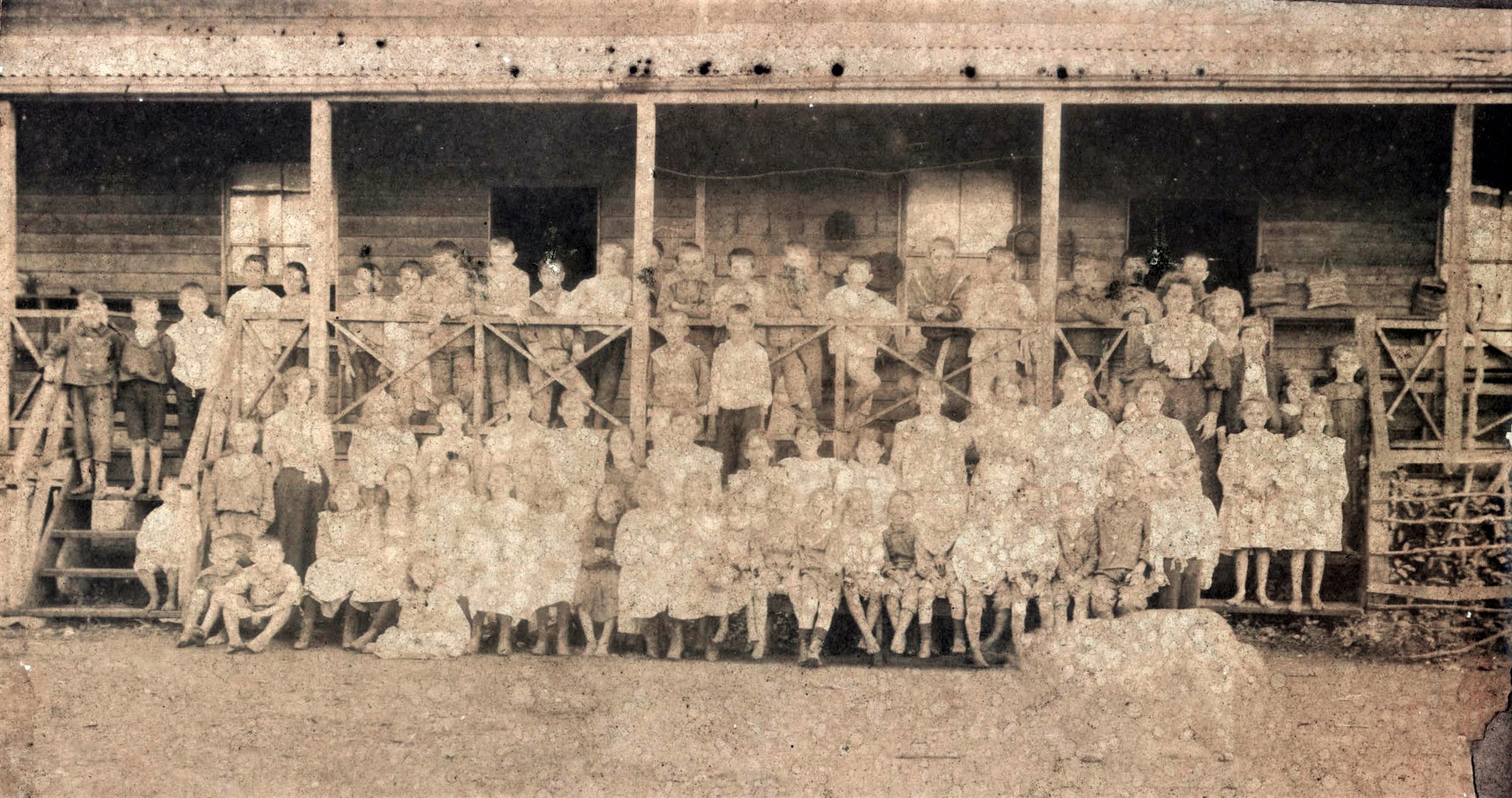
The Williams family also established several businesses including a grocery store, dairy, livery stable, wood depot, maize storage and slaughter yards. Water was pumped from a dam on Peterson Creek and reticulated from a storage tank. Before the railway reached Yungaburra in 1910, the Williams family built a new hotel opposite the railway station, which still stands at this location today. It was originally known as the Lake Eacham Hotel but more recently changed to Yungaburra Hotel. Much of the timber from the original hotel building was used in the construction of buildings in Cedar Street, opposite the hotel.
The Seven Sister hills in the distance are a series of volcanic cinder cones. You can find out more about the volcanic history of this area at the Malanda Falls Visitor Centre.
This is the site of the former Golf Club clubhouse, which is now a private residence. The golf course was a popular tourist attraction and was used by residents and visitors.
Williams Park was designated as a community parkland in 1983 and opened by Sir Edward Williams and Sir Sydney Williams, grandsons of the original settlers. In the early days a tennis court, football field and cricket pitch provided sporting recreation for local and rival sports enthusiasts.
It is hard to appreciate that this large area of gently sloping and vegetated land was once the place of a nine-hole course. This marker is near the first tee.
Led by a small group of dedicated Yungaburra residents, the Williams Park gardens were established in 2012 and are maintained by local volunteers and Tablelands Regional Council. The gardens have a range of native plants including callistemons, wattles and grevilleas, as well as a wide variety of exotic species. The gardens provide habitat for native animals and birds.
This raised section of the track follows the route of the ‘new’ railway line.
From here you can choose a shorter walk along the unsealed roadway, locally known as Lyn’s Lane after Lyn Williams, to Stewarts Gully Road. Turn right to return to the trailhead.
From the early 1900s railway travel was an important part of the Tablelands’ regional development, and a branch line to Yungaburra was eventually established in 1910. When Lake Tinaroo was constructed in 1959, a new railway line was built to bypass the now-underwater township of Kulara. This cutting and the nearby bridge were part of this new line, which also passed through an area that was previously used as a WWII machine gun practice range (left-hand side of the cutting).
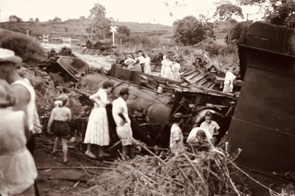
This steel-girder bridge crossing Peterson Creek was only used for six years before it was closed. About a year after the opening of the railway line, a tragic accident occurred on the other side of the bridge. A steam train derailed, trapping the stoker, who passed away from his injuries.
Learn about the history and construction of the bridge from the nearby sign.
From here, return to the road and turn left onto the Casuarina Walk. You’ll walk through a cool forest of natural regrowth. Stop for a rest at the timber seat, placed by an early track pioneer David Leech.
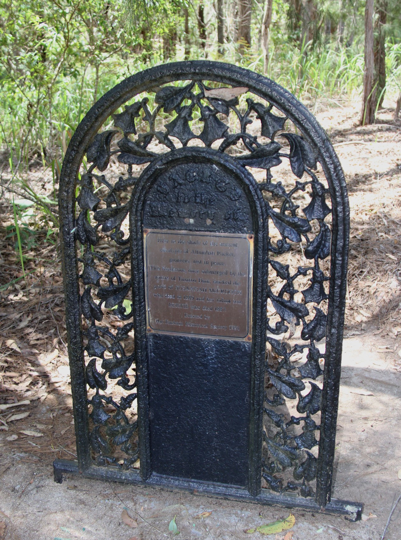
In 1911 this land was surrendered by the Department of Education to the Department of Public Lands for use as a cemetery and the first known burial was held in 1914. Many well-known settler family members are laid to rest here.
On the right-hand side, just inside the entrance gate, is the wrought-iron headstone that originally marked the graves of Susan McCrohan and her infant son, Bertie John. They lived and were buried at Boar Pocket, but their graves are now under the waters of Lake Tinaroo.
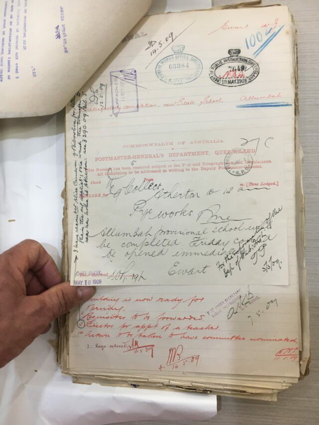
In 1909 the original Allumbah School was established on the portion of land that is now the Yungaburra Cemetery. In 1910, and coinciding with the opening of the new railway line, the school was moved to a new location on Maple Street, and its name changed to conform to the town’s new name, Yungaburra. The school building was later relocated and is still in use as the police station in Cedar Street.
This gently sloping section of the trail runs through a regrowth forest and is home to wallabies, pademelons, bandicoots, lizards, brush-turkeys and a plethora of other birdlife. Stay on the trail to avoid becoming lost.
Turn right here to return to Yungaburra, or left to follow the route of the original rail line running parallel with the Stewarts Gully. This gully used to flow into Peterson Creek but the junction is now under Lake Tinaroo.
Follow the track onto the old railway line. Steam trains used to regularly run along this line between Yungaburra, Kairi and Tolga via Kulara.
In 1890 much of this area, approximately 80 acres, was settled by John Stewart. Over time the Stewart family established a successful mixed farming business, and their homestead became a staging post for weary travellers.
From here return along Stewarts Gully Road to the next point.
The junction of the new railway diversion around the lake and the older original line was in this vicinity. Both lines continued into the new township of Yungaburra.
The community tennis courts used to be located where the last residence on the right-hand side now sits.
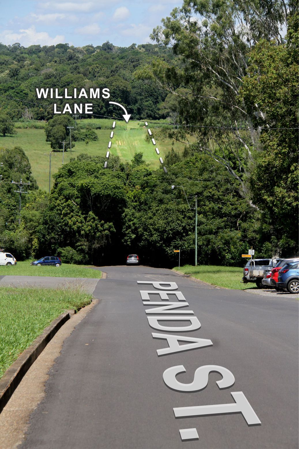
Look down Penda Street and across Petersen Creek and you see Williams Lane in the distance. This was the original road into Allumbah.
See Eacham Historical Society’s bulletins for more information.
